Overview
This is not a ride you stumble into. The American Fork to Midway MTB Loop covers 54 miles and 7,500 feet of climbing by linking the American Fork Canyon trail network to the Wasatch Mountain State Park trails near Midway via the Mineral Basin Road (Forest Road 085) and Snake Creek Pass. It's a point-to-point or shuttle loop depending on logistics, a mixed-surface adventure that alternates between proper singletrack and forest road, and one of the longer backcountry MTB link-ups accessible from the Wasatch Front.
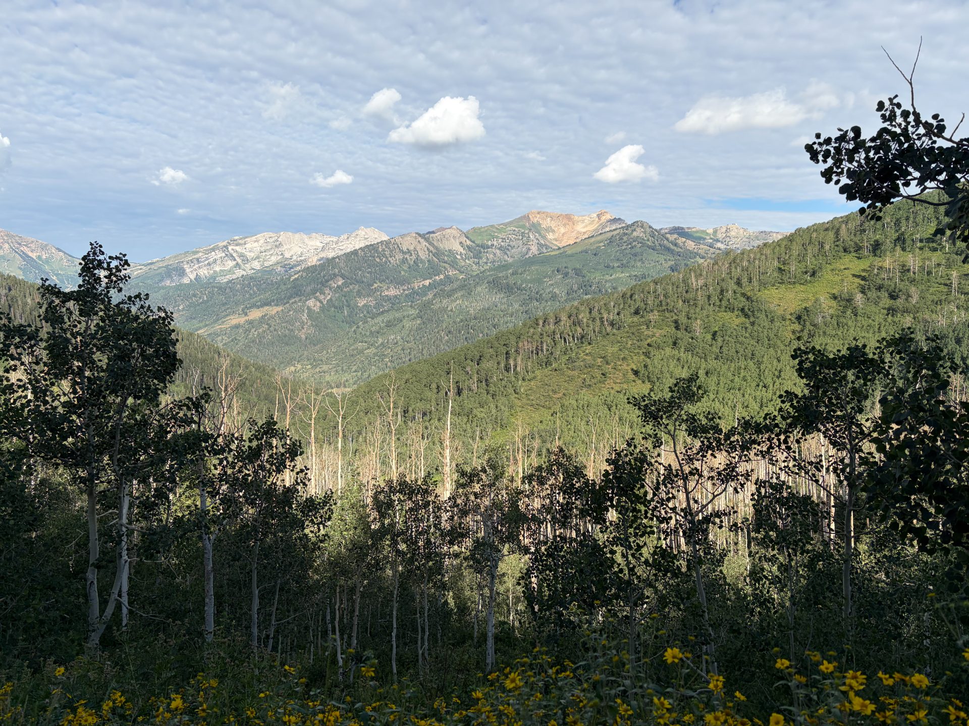
The climbing is cumulative and unrelenting rather than savage in single sections — this is a route that grinds you down through sheer distance and sustained effort. What you get in return is a crossing of the Wasatch that most riders never experience: the remote upper drainage of American Fork Canyon, the high alpine plateau above Tibble Fork Reservoir, and the descent into the Heber Valley from a vantage point that makes Utah Valley look like a map.
Note: Forest Road 085 (Mineral Basin Road) is subject to seasonal closures and has been closed to motorized vehicles in recent years; always check current status with the Uinta-Wasatch-Cache National Forest before committing to this route. When the road is closed to vehicles, it's excellent for bikes.
The Route
The route begins at the American Fork Canyon trail network, climbs through the canyon system to Tibble Fork Reservoir, continues up Mineral Basin Road to Snake Creek Pass, and descends into the Midway/Heber area to connect with Wasatch Mountain State Park trails.
Miles 0–10: American Fork Canyon Approach The opening miles follow American Fork Canyon trail network, climbing through a landscape that shifts from dry scrub oak at the canyon mouth to pine and aspen as elevation accumulates. The trails in the lower canyon are well-maintained singletrack with a mix of smooth dirt and occasional rocky sections. Traffic from other trail users is highest here — this is the most-ridden section of the American Fork system and it shows. Settle in, find a sustainable pace.
Miles 10–20: Tibble Fork and Mineral Basin Road At roughly mile 10, the route reaches Tibble Fork Reservoir at 6,741 feet — a natural checkpoint, a good place to refuel, and the last reliable water source before the high country. From here, Mineral Basin Road (FR 085) begins climbing in earnest toward the basin above. The road is wide and well-graded, gaining elevation steadily through terrain that becomes increasingly sparse and alpine. The aspens thin out, the views open up, and the climbing becomes the kind that asks real questions about your preparation.
Miles 20–30: Mineral Basin and the High Plateau The upper Mineral Basin section sits above 9,000 feet in open, exposed terrain with long sight lines across the Wasatch ridge. This is among the most remote-feeling terrain accessible by bike from the Wasatch Front — no cell service, no facilities, occasional OHV traffic when the road is open to vehicles. The surface is packed dirt and gravel, mostly rideable, with some rocky sections that reward a confident line choice. Snow can linger here through early July in heavier winters.
Miles 30–38: Snake Creek Pass and Descent to Heber Valley The route crosses Snake Creek Pass and begins the descent into the Heber Valley drainage. The descent is long and rewarding — the Heber Valley opens below you, framed by the Uinta Mountains to the east and the Wasatch Ridge behind. The road surface improves as you lose elevation. This is where you finally get to stop pedaling hard and let the bike do the work for a few miles.
Miles 38–54: Midway Trails and Return The final section enters the Wasatch Mountain State Park trail network near Midway, including the WOW (Wasatch Over Wasatch) trail system, which weaves through high-alpine aspen, pine forest, and high-desert rock before dropping toward the valley floor. The WOW trail alone adds nearly nine miles of genuine singletrack to close out the ride. If the legs are still there, this is a great ending — swooping singletrack through varied terrain with the Heber Valley spread below.
What to Bring
- 3 liters of water minimum — the route between Tibble Fork Reservoir and the Heber Valley floor has no reliable water; treat any natural source before drinking
- Substantial food — six hours of hard effort at altitude burns through supplies; carry more than you think you need
- Navigation — download the route to Gaia GPS or Trailforks before you leave; cell service disappears above the canyon and the Mineral Basin junction is not always obvious
- Tools and tubeless repair kit — you're remote and a flat on FR 085 means a long walk; carry two CO2s, a plug kit, and a multi-tool at minimum
- Packable insulation — the Mineral Basin plateau and Snake Creek Pass can be 25°F colder than the valley with significant wind; a lightweight puffy takes up almost no space and matters a lot when you stop at the pass
- Shuttle plan or extra battery — if running point-to-point, sort logistics before the ride; if looping back on road, know the route home
Local Tips
- Best window: Mid-July through mid-September, after the Mineral Basin snowpack has cleared; September offers the best conditions with fall color starting in the upper canyon
- Check FR 085 status first: The Mineral Basin Road has been closed to motorized vehicles and closures change; confirm current access with Uinta-Wasatch-Cache National Forest before the day-of
- Start early: A 6:00–6:30am start puts you off the Mineral Basin plateau before afternoon thunderstorms develop, which is the sensible move at 9,000 feet
- Midway finish: If running point-to-point, Midway has a gas station and the Zermatt Resort area for food — not glamorous, but functional after six hours in the saddle
- Post-ride: The Communal Bakehouse in American Fork if you're looping back, or Snake Creek Grill in Heber City for a proper meal after a point-to-point finish