Overview
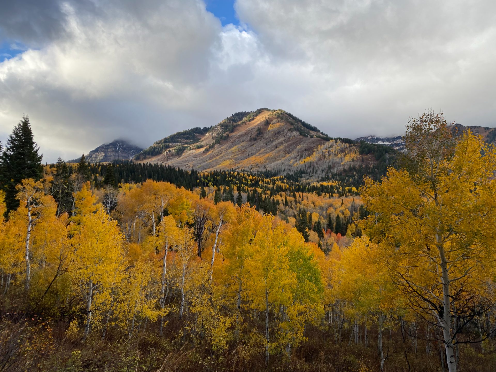
The Alpine Loop is the closest thing Utah Valley has to a signature road ride — a full loop over SR-92 that links American Fork Canyon with Provo Canyon via a summit that touches 8,000 feet and puts Mount Timpanogos close enough to feel imposing. At 41 miles with 3,500 feet of climbing, it's a genuine day out, not a morning spin, and the route earns its reputation through variety: a long canyon grind, an exposed alpine section, and a descent through old-growth aspens that most riders remember for the rest of the season.
The loop runs best as a clockwise route — climbing American Fork Canyon and descending into Provo Canyon — though the counterclockwise direction has its advocates. Either way, you're looking at two meaningful climbs: the long haul up SR-92 from the canyon mouth to the high point near Cascade Springs Road, and the shorter but still honest Provo Canyon approach on US-189. What makes this ride worth the car fee and the early start is the quality of the road surface, the drama of the terrain, and the fact that the summit views are legitimately some of the best accessible by pavement in the Wasatch.
The Alpine Loop Scenic Byway is seasonal — typically open late May through October, depending on snowpack. Check conditions in early season; the upper road can stay icy well into June in a heavy snow year.
The Route
The loop starts from the American Fork Canyon entrance on SR-92 and traces a clockwise arc through the Uinta-Wasatch-Cache National Forest before dropping into Provo Canyon and returning via US-189 and surface streets.
Miles 0–5: American Fork Canyon Lower From the fee station at the canyon mouth (~5,000 ft), the road settles into a consistent 4–6% grade through the lower canyon. The walls close in early, traffic is heaviest here, and the road is wide enough to share with cars without much stress. The climbing is steady and predictable — use these miles to find a rhythm and resist the urge to push too hard before the real work starts.
Miles 5–12: Into the Canyon The road narrows and the aspens begin in earnest. Traffic thins out as you leave Sundance Resort behind — cyclists who turn around at Sundance are missing the best part. The grade holds in the 5–7% range through this stretch, occasionally spiking on the switchbacks in the upper canyon. The canyon walls shade the road in the morning, which makes this one of the better early-start climbs in the state during summer.
Miles 12–16: The Summit Section The final push to the high point near Cascade Springs Road junction (approximately 8,000 ft) is where the route opens up into something genuinely alpine. Timpanogos fills the view to the northeast — the mountain is enormous from this angle, all ridge and snow and vertical scale that makes 8,000 feet feel earned. The Timpooneke Trailhead appears on the left just before the summit plateau. The grade eases slightly at the top; if your legs are full of acid, this is when you'll notice.
Miles 16–24: The Provo Canyon Descent The descent off the Provo side of SR-92 is one of the better road descents in Utah — winding aspen forest, good pavement, and enough switchbacks to keep speeds interesting without being sketchy. The road is narrow in spots, so check your speed going into corners with limited sightlines. You drop from 8,000 feet to the Provo Canyon floor at roughly 4,500 feet over eight miles. That's a lot of altitude lost fast — bring a layer.
Miles 24–41: Provo Canyon and the Return At the bottom, you turn northwest onto US-189 through Provo Canyon toward Orem and the valley. This section is flatter and faster, with the Provo River running alongside. Traffic increases significantly once you're on US-189 — stick to the shoulder and stay alert. The road surface is good but the lane widths are tighter than you'd like. From Orem, surface streets return you to American Fork Canyon. This final stretch is where tired legs meet suburban roads: manage the effort and save something for the last few miles back to the car.
What to Bring
- 2–3 water bottles — the canyon has no refill points and the summit section is exposed and dry
- Layers — the summit runs 15–20°F cooler than the valley floor; the Provo Canyon descent at speed is cold even on warm days
- Cash or card — $6 day use fee at the American Fork Canyon entrance
- Food — four to six hours is a long time; bonking on the descent is a miserable experience
- Sunscreen — the summit plateau is exposed and above most of the UV-blocking haze that sits over the valley
Local Tips
- Best window: Weekday mornings in September — the aspen color starts turning in the upper canyon, traffic is minimal, and the temperatures are ideal for a big effort
- Sundance traffic: Summer weekends, especially Saturdays, bring heavy car traffic through the Sundance section — start by 7am or accept company on the climb
- Fee station: The fee is collected on entry to American Fork Canyon; keep cash or card accessible at the start
- Combine it: Strong riders sometimes add Cascade Springs Road as a side excursion from the summit junction — adds distance and a gorgeous traverse above the canyon, though the road surface can be rough
- Post-ride: Communal Bakehouse in American Fork (or grab something in Provo Canyon at the Sundance Deli on the way through if timing works)