PROJECT

PEDAL

RegionsRace CoursesSeasonal GuideAbout

PROJECT

PEDAL

Utah's premier cycling guide. Ride guides, GPX downloads, and local expertise for every type of cyclist.

Explore

  • Regions
  • Race Courses
  • Seasonal Guide
  • About
  • Request a Review

Resources

  • Browse Rides

Legal

  • Privacy Policy
  • Terms of Use

© 2026 Project Pedal. All rights reserved.

Made with love for Utah cyclists.

Tibble Fork Road Climb
Regions/Utah County/Tibble Fork Road Climb
RoadModerateOut-and-back

Tibble Fork Road Climb

Distance

16.8mi

Elevation Gain

+1,734ft

Est. Time

1.5–2.5 hours

Season

May - October

Hover to explore

Elevation Profile

0.0 mi0 ft5,017 ft above sea level
+1,723ft+1,7230ft2mi4mi6mi8mi10mi12mi14mi16mi

Overview

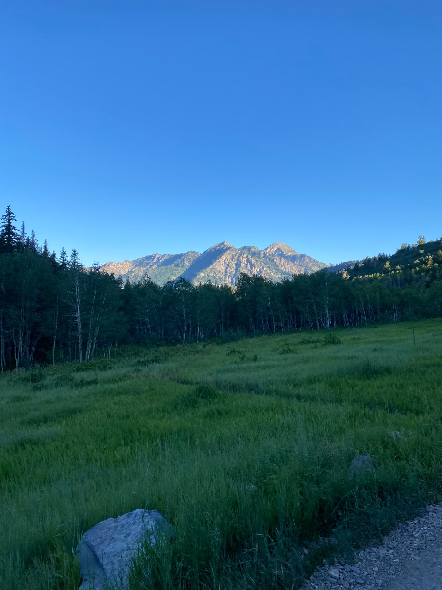
Tibble Fork is American Fork Canyon's quieter sibling — a road that branches off SR-92 past the fee station and climbs through pine and aspen to a reservoir at 6,741 feet, with a fraction of the traffic that packs the main Alpine Loop on a summer weekend. At 16.79 miles round trip with 1,734 feet of gain, it's a solid half-day effort for most road riders: long enough to feel like a real climb, short enough to stack with something else if you have the legs.

The $6 canyon entry fee applies here — same as the Alpine Loop — but you're buying a much calmer experience. The Tibble Fork road narrows past the junction, which tends to keep the recreational vehicles on SR-92 and leaves this stretch to cyclists, hikers headed to the reservoir, and the occasional car that knows where it's going. The canyon walls close in, the trees thicken, and the road quality holds well enough to keep you rolling efficiently through the climb.

This is a good ride for road cyclists who've done the Alpine Loop enough times to want a variation, or who want the American Fork Canyon experience at a quieter time of year. The season runs May through October — snow closes the upper section reliably before and after that window, and late-season shoulder visits in September and October tend to hit the aspen color change at its best.

The Route

The ride starts at the American Fork Canyon mouth on SR-92, climbs the main canyon road to the Tibble Fork junction, then follows the Tibble Fork road to the reservoir and back.

Miles 0–3: American Fork Canyon (SR-92) The first three miles follow SR-92 from the fee station up the main American Fork Canyon. The road is well-maintained and moderately trafficked — expect a mix of cars headed to Tibble Fork, hikers bound for the Stewart Falls trailhead, and cyclists doing the Alpine Loop. The gradient is a manageable 4–5% here, with the canyon creek on your right and walls rising on both sides. Use this section to warm up properly; the Tibble Fork road is steeper and narrower, and arriving there cold makes the transition harder.

Miles 3–8.4: Tibble Fork Road The turn onto Tibble Fork Road comes at a clear junction — bear left off SR-92. Almost immediately the character changes: the road narrows to a single-lane-with-passing-spots situation, the trees close in on both sides, and vehicle traffic drops to near nothing on most days. The grade increases to the 6–9% range and stays there with few breaks. Aspen and pine filter the light, and in late September or October the color can be exceptional. Watch for soft road edges — the surface is good but the shoulders are not maintained, and a tire off the pavement on the descent is a mistake.

Miles 8.4: Tibble Fork Reservoir The reservoir sits at 6,741 feet in a wide, quiet basin. It's a genuine destination — worth stopping, taking in the view, and eating something before you turn around. Seasonal facilities may be present near the reservoir, but do not count on them for water. The road continues beyond the reservoir but deteriorates quickly and is not suitable for road bikes. This is your turnaround.

Miles 8.4–16.79: The Return Descend the Tibble Fork road with care — the narrowness that made the climb peaceful now requires your full attention coming down. The road has passing spots but no clear sightlines through some turns, so hold a speed you can modulate. Once back on SR-92, the descent to the canyon mouth is straightforward and fast.

What to Bring

  • 2 full water bottles — Reservoir-area facilities are seasonal and unreliable; carry what you need from the car
  • $6 cash or card — American Fork Canyon day-use fee at the entrance station
  • Extra layer — The reservoir basin at 6,741 feet sits in shade for most of the morning and cools quickly when the sun drops behind the ridge
  • Spare tube and pump — The Tibble Fork road has gravel near the edges; a slow puncture on the descent is an inconvenience worth preparing for

Local Tips

  • Best window: July through September. The road opens in May but can have frost heaves from winter damage — check conditions before an early-season visit. September and October bring the best aspen color and the least traffic.
  • Combine it: Ambitious riders link Tibble Fork with the full Alpine Loop by continuing up SR-92 after returning from the reservoir. Add 25 miles and 2,000+ feet; bring extra food and confirm your timing against the canyon closure schedule.
  • Traffic: Weekday mornings are noticeably quieter on SR-92 than weekends. If you're doing this on a Saturday in July, expect company on the main canyon road.
  • Post-ride: Communal Kitchen in American Fork is 10 minutes from the canyon mouth and one of the better lunch spots in Utah Valley — strong sandwiches, no fuss.

Photos · 1

At a Glance

EasyModerateHardExpert

Descent

1,645 ft

Avg Grade

4%

Max Grade

8.1%

Surface

Paved

Free

GPS Route File

Works with Garmin, Wahoo, Komoot, and all major cycling apps.

Get Directions

Navigate to trailhead

Need to Know

  • The road narrows significantly past the Tibble Fork junction — use caution with oncoming traffic
  • Day use fee required at the American Fork Canyon entrance
  • The upper section near the reservoir is exposed and can be windy
  • Road may have rough patches after winter — watch for frost heaves in early season
  • Turnaround at or near the reservoir; the road beyond is rough and not suitable for road bikes

Logistics

Fee $6 day use (American Fork Canyon)
Restrooms Yes, at trailhead
Water Tibble Fork Reservoir area has seasonal facilities — do not count on them; carry 2 bottles
Cell Signal Lower canyon only — fades past the fork
Shade Good — canyon walls and tree cover for most of the climb
Parking

Park at the American Fork Canyon mouth near the fee station on SR-92. The Tibble Fork route branches off the main canyon road — fee applies ($6 day use).

Best Times to Ride

Jan
Feb
Mar
Apr
May
Jun
Jul
Aug
Sep
Oct
Nov
Dec
Excellent
Good
Fair
Poor
Closed